


Voting District 0007, Nash County, North Carolina
About
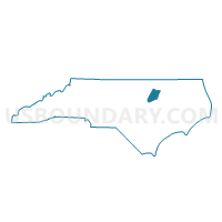
Outline

Summary
| Unique Area Identifier | 640940 |
| Name | Voting District 0007 |
| County | Nash County |
| State | North Carolina |
| Area (square miles) | 59.31 |
| Land Area (square miles) | 59.29 |
| Water Area (square miles) | 0.02 |
| % of Land Area | 99.96 |
| % of Water Area | 0.04 |
| Latitude of the Internal Point | 36.12098790 |
| Longtitude of the Internal Point | -77.96326780 |
Maps


Graphs
Select a template below for downloading or customizing gragh for Voting District 0007, Nash County, North Carolina


Neighbors
Neighoring Voting District (by Name) Neighboring Voting District on the Map
- Voting District 0003, Nash County, NC
- Voting District 0015, Nash County, NC
- Voting District 0022, Nash County, NC
- Voting District 0026, Nash County, NC
- Voting District 10, Franklin County, NC
- Voting District 8, Warren County, NC
- Voting District HOL, Halifax County, NC
- Voting District RINGW, Halifax County, NC
Top 10 Neighboring County Subdivision (by Population) Neighboring County Subdivision on the Map
- Nashville township, Nash County, NC (10,238)
- Brinkleyville township, Halifax County, NC (5,159)
- Red Oak township, Nash County, NC (3,581)
- Griffins township, Nash County, NC (2,890)
- North Whitakers township, Nash County, NC (2,471)
- Castalia township, Nash County, NC (2,030)
- Fishing Creek township, Warren County, NC (1,781)
- Gold Mine township, Franklin County, NC (1,630)
Top 10 Neighboring Place (by Population) Neighboring Place on the Map
Top 10 Neighboring Unified School District (by Population) Neighboring Unified School District on the Map
- Nash-Rocky Mount Schools, NC (106,786)
- Franklin County Schools, NC (60,619)
- Halifax County Schools, NC (32,513)
- Warren County Schools, NC (20,972)
Top 10 Neighboring State Legislative District Lower Chamber (by Population) Neighboring State Legislative District Lower Chamber on the Map
- State House District 49, NC (77,779)
- State House District 25, NC (73,935)
- State House District 27, NC (68,869)
- State House District 7, NC (59,436)
Top 10 Neighboring State Legislative District Upper Chamber (by Population) Neighboring State Legislative District Upper Chamber on the Map
- State Senate District 7, NC (186,929)
- State Senate District 11, NC (177,074)
- State Senate District 4, NC (163,184)
Top 10 Neighboring 111th Congressional District (by Population) Neighboring 111th Congressional District on the Map
- Congressional District 2, NC (741,576)
- Congressional District 3, NC (735,979)
- Congressional District 1, NC (635,936)
Top 10 Neighboring Census Tract (by Population) Neighboring Census Tract on the Map
- Census Tract 108, Nash County, NC (7,195)
- Census Tract 109, Nash County, NC (5,502)
- Census Tract 9308, Halifax County, NC (5,312)
- Census Tract 602, Franklin County, NC (3,711)
- Census Tract 9501.03, Warren County, NC (2,597)
Top 10 Neighboring 5-Digit ZIP Code Tabulation Area (by Population) Neighboring 5-Digit ZIP Code Tabulation Area on the Map
- 27549, NC (24,112)
- 27856, NC (17,141)
- 27823, NC (8,201)
- 27891, NC (5,227)
- 27844, NC (2,950)
- 27816, NC (2,516)